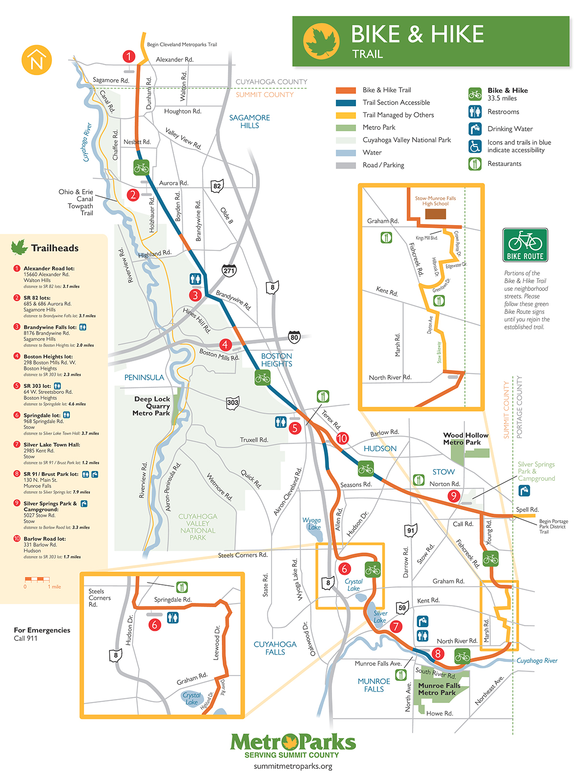
Bike and Hike Trail — Munroe Falls, OH to Northfield Center, OH
- Details
- Hits: 8925
Bike and Hike Trail 27-Mile Bike Ride
Come out for a ride! This is part of a trail ride series sponsored by the Ohio River Trail Council (ORTC) intended to bring awareness to the wonderful trails in our quad-state region (Maryland, Ohio, Pennsylvania and West Virginia). All cyclists are welcome for this rails-to-trails, moderate-paced ride!
Join us, as we visit the Bike and Hike Trail. The ride departs from the southern trailhead on N. Main Street in Munroe Falls. and we ride north to Brandywine Falls in Northfield Center, Ohio. The trail is of intermediate difficulty to ride and provides a total of 27-miles of scenic biking.
Don't forget your camera!
Trailhead
Munroe Falls Trailhead - 154 N Main St, Munroe Falls, OH 44262
GPS: 41.143166, -81.439033
Features and Points of Interest:
The 34-mile Bike & Hike Trail was one of the first "rails to trails" conversions in the country. Sections of the Bike & Hike Trail follow the course of two abandoned former railroads. Much of the trail follows the Lake Erie & Pittsburgh Railroad (LE & P), later named the New York Central Railroad (NYC) before it was abandoned and converted to trail. Another portion of the trail rests on the old Akron, Bedford & Cleveland Railroad (AB & C, or the "Alphabet Railroad"), an electric railway for interurban passengers that went into service in the late 1800s. Until service was discontinued in 1932, riders could travel for 50 cents from Akron to Cleveland’s Public Square in about 2.5 hours.
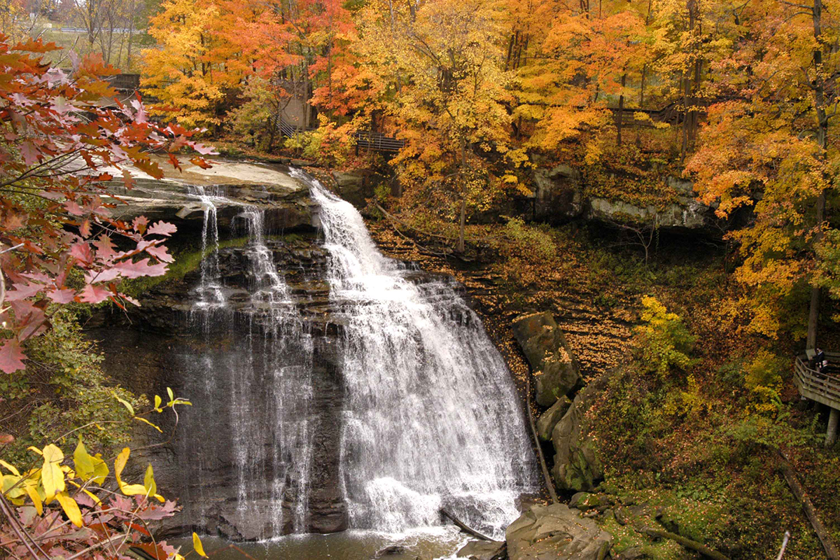
Today, east of Route 91 in Munroe Falls, the Bike & Hike Trail parallels a scenic section of the Cuyahoga River where great blue herons, Canada geese and a variety of ducks can be seen. A small pond along the north side of the trail annually hosts a chorus of spring peepers. South of Boston Mills Road in Boston Heights, the Sharon Conglomerate rock walls of the Boston Ledges rise along the trail. Farther north, the trail travels along Brandywine Road. A parking area adjacent to the bridge over I-271 offers rest and a view of Brandywine Falls which, at 75 feet, is one of the highest waterfalls in Ohio.
All 34 miles of the Bike & Hike trail are paved. Some portions of the trail use neighborhood streets. Please follow the green biking signs until you rejoin the established trail. For your convenience, restrooms are located at the Brandywine Falls, SR 303, Springdale, Silver Springs and SR 91 lots.
Map
Social
Optional social gathering and dinner will be held after the ride.
| [ ] |