Southwestern Pennsylvania Commission
- Details
- Hits: 4814
Southwestern Pennsylvania Commission
Transportation: Pedestrian-Bicycle Committee
Encouraging safe, efficient travel for pedestrians and cyclists is an important part of SPC's role as a regional transportation agency. Bicycling and walking offer excellent commuter options that support our overall mission to reduce traffic congestion and improve air quality. Communities that are pedestrian- and bicycle-friendly are also “livable,” providing residents with opportunities for recreation and community-enhancing economic development.
SPC’s Pedestrian and Bicycle Committee addresses issues of concern and pursues priority improvements of regional significance. This committee is composed of representatives from SPC-member counties, the City of Pittsburgh, transit agencies, PennDOT, trail organizations, and advocates for pedestrians, bicyclists, and persons with disabilities.
Bicycle Suitability Evaluation Project
SPC’s transportation planners have undertaken a project to evaluate the cycling conditions of the regional state highway network. Based on the evaluation of a combination of traffic volumes, roadway geometry, and field observations, maps will periodically be created that can be used as a reference tool by cyclists and cycling commuters. The maps indicate the roadways as being above average, average or below average for cycling, as well as other features relevant to cyclists such as significant hills, trails, park-n-ride lots, and bicycle parking. These maps are intended to connect with and build out from the existing Bike-Pittsburgh Bike Map.
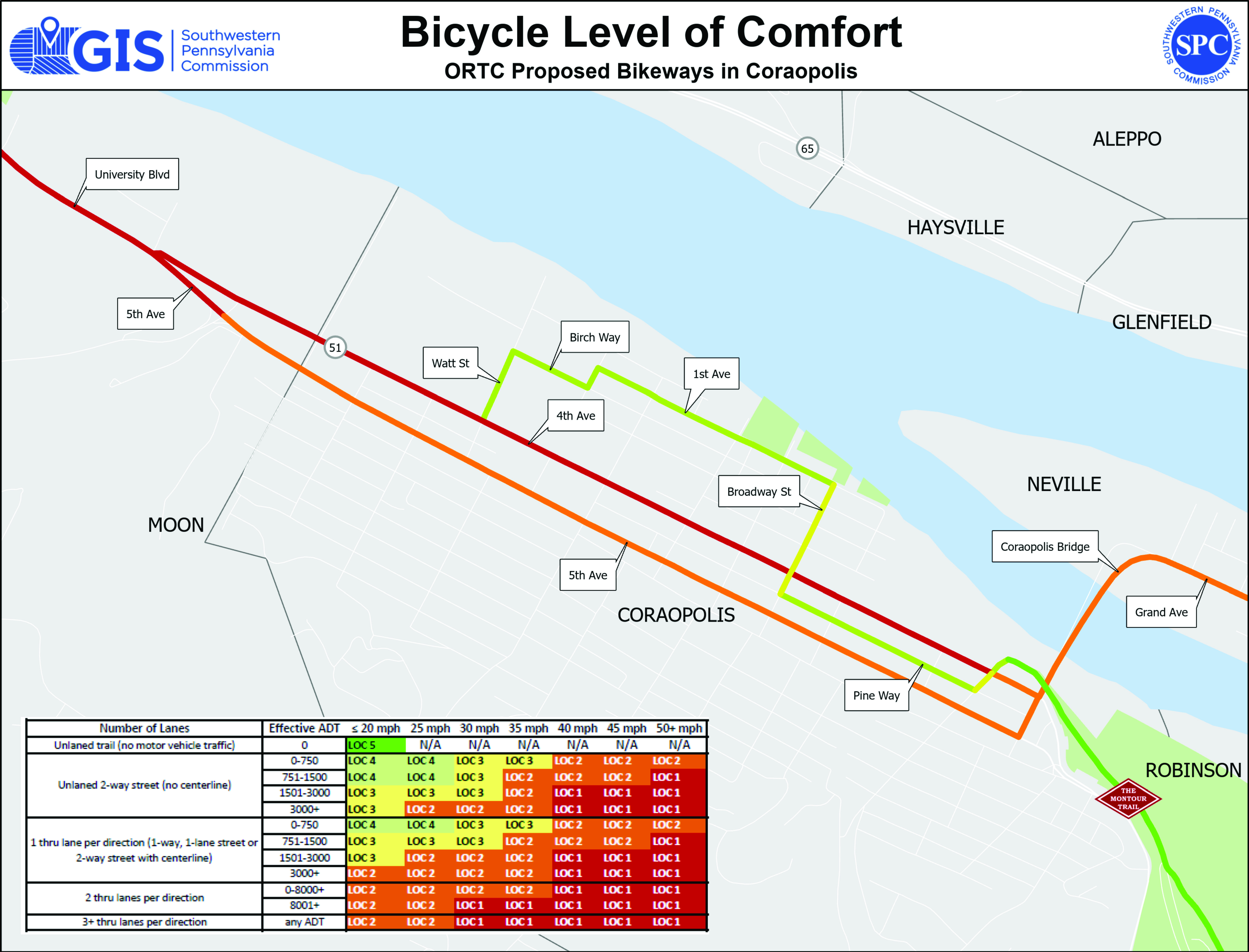
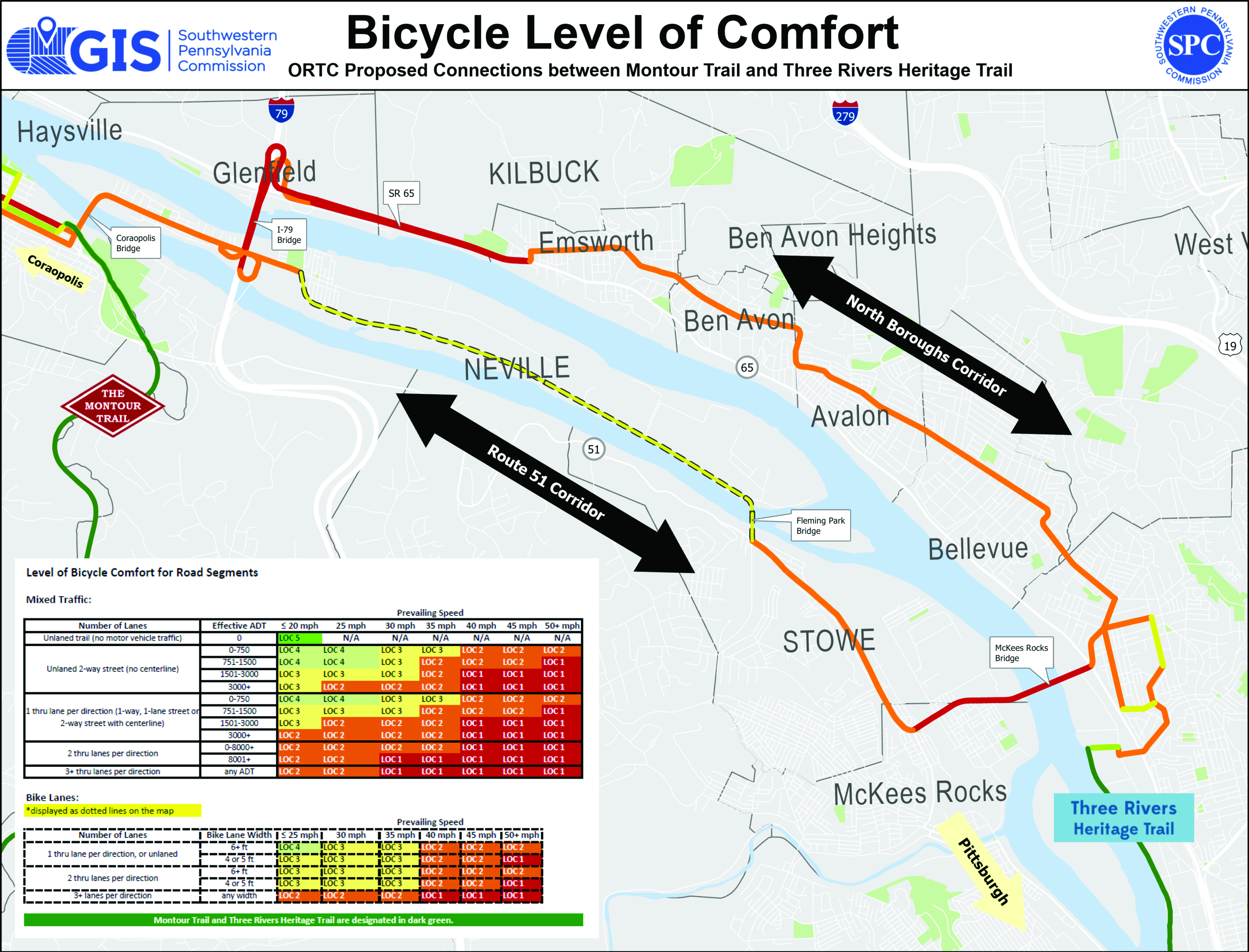
The SPC is providing technical support for the Ohio River Trail Council to develop maps in Beaver & Allegheny County along the Ohio River Greenway Trail corridor. The purpose of which is to provide information to choose the “safest” on-road route following the Beaver and Ohio River from N.E. Ohio to the Great Allegheny Passage.
To view the ORTC Coraopolis, Pa Bicycle Level of Comfort mapping click here.
To view the ORTC Bicycle Level of Comfort mapping between the Montour Trail and the Three Rivers Heritage Trail click here.
To view the regional Bicycle Level of Comfort GIS Mapping, click here.
For additional information, please visit - http://spcregion.org/trans_pedbike.shtml
Did You Know?
People around the world recognize southwestern Pennsylvania as a model of trail development. With the completion of the Great Allegheny Passage and related trail development, Pittsburgh will be the northern terminus of a continuous, off-road trail extending from Pittsburgh to Washington, D.C.